Title
Settlement
Text
Land Grant Number
Acres
Date
Text
Text
Text
Give a brief description of the inhabitant. The man. The legend. Do we know any significant details about these guys? If yes, great! Include that here. If not, then this can just be ignored.
Archibald Taylor
Settlement
Clarencetown & Miley
Grants
D-3 (300 acres, 23 Dec 1788), D-4 (300 acres, 26 Dec 1788), D-30 (120 acres, 26 Dec 1789), D-33 (400 acres, 5 Dec 1789)


Archibald Taylor. Origin: Loyalist.
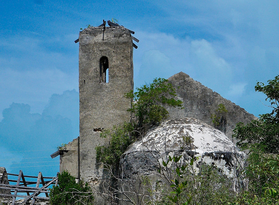
Archibald Taylor had previously been a Major in the Royal Militia of North Carolina, and received compensation of 308 pounds from the Crown on his claim of 1078 pounds for loss of property in North Carolina. He and his brothers Duncan and Alexander Taylor came to the Bahamas from Scotland, via North Carolina where, led by Archibald, they founded the settlement of Clarencetown. Within the Clarencetown settlement, Taylor also founded Victoria Village and Harbour Settlement. Victoria Village was an area of land reserved for the tiny houses of freed slaves, but no longer exists today. Chancery Pond was used to create a series of salinas, and it was Archibald Taylor’s slaves who dug a majority of the canals in and around Clarencetown, used to supply water to and from the Salinas.
Taylor received four large parcels of land in the Clarencetown area of Long Island, the earliest of which was 23 December 1788 (D-3). It was 300 acres at Great Harbour (now part of Clarencetown), and bounded by the harbor, by the land of John Gibson, and by vacant land on two other sides. His second grant of 300 acres on 26 December 1788 (D-33) was bounded by the sea, a salina, and vacant land on the other sides. We interpret the large amount of surrounding vacant land to mean that he and John Gibson were the first to receive land in this area, and this is backed up by a 1785 enumeration of early cotton production in the Bahamas, wherein it was noted that “Taylor & Gibson” were two of the four earliest cotton plantations on the island. In fact, all but 4 of the land grants in the entire Clarencetown settlement were owned by Taylor or Gibson, or Taylor and Gibson, as depicted on the Tatnall and Lands & Surveys Maps.
On 5 December 1789, he received another 400 acres in the Great Harbour settlement. It was bounded by the land of Thomas Smith, Esq., Gibson & Taylor, the sea, and his own land. He then received a grant of 120 acres in the Miley area of Long Island on 5 December 1789. It was bounded by a salina, and westerly by John Gibson, and southwest and southwesterly by vacant land. This potion of both the Lands & Surveys map, and the Tatnall map, are full of errors and do not exactly match the actual deed. His brother Duncan also received an adjacent grant in this area.
It is interesting to note that he received a 10-year waiver of quit rent on the first two parcels granted in 1788 (one of which stated “Loyalist”), but only a two 2-year waiver on the two parcels he received the following year.
References: LCS, HB.